Temburong District
The Temburong District is separated from the rest of Brunei by Brunei Bay and a sliver of Sarawakian territory. Temburong hovers to the northwest of Bandar Seri Begawan, summoning visitors to take the short step into another world.
The Temburong District is rich in unspoiled natural heritage, including the Ulu Temburong National Park (formerly the Batu Apoi Forest Reserve). Here the magnificence of Borneo's lowland rainforests can be truly experienced. Botanically, the area possesses astounding diversity, however the casual visitor in search of birds or mammals is likely to be disappointed by the apparent lack of fauna. In fact the forests teem with wildlife, but these creatures are invariably shy and are quick to avoid human contact. The best time for viewing the wildlife is at dawn or dusk.
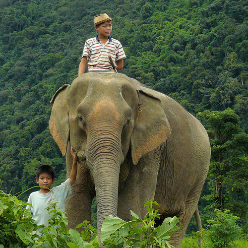
On the river trip to Bangar , which is Temburong District's main town, you will see monkeys in the mangroves and monitor lizards basking in the sun at low tide. Some patches of land have been cultivated by resident Murut and Iban Malays, virgin rainforest flourishes across the greater part of Temburong.
Frequent speed boat ferry services are available between Bandar Seri Begawan and Bangar. The river trip takes less than an hour. There is no departure schedule, boats leave when they have collected 12 passengers. The last boat from Bangar to Bandar Seri Begawan departs at 16.00 hrs.
Temuai (dug-out longboat) can be hired in and around Bangar to go up-river and are still the best way of experiencing the jungle waterways of Borneo.
Kuala Belalong Mini Park
This park was opened on 22 July 1993, by the Sultan when he visited the district on his 47th birthday. Kuala Belalong Mini Park's gardens incorporate a number of attractions echoing the renowned Kuala Belalong Field Studies Centre (see below)The park is located about 1 kilometre from Bangar, the main town, Bangar. Its features include a pond used for remote-controlled boat racing and six pondok (huts) of similar design to those at the Kuala Belalong Field Studies Centre. Three pondoks house pictorial records of the sultan's visit to Temburong and the activities of the local people, while the other three house findings made at the Kuala Belalong Field Studies Centre.
The park is an excellent alternative for those unable to visit the more remotely located Kuala Belalong Field Studies Centre.
Batang Duri Park
Batang Duri Park is bordered by towering forest and overlooks the crystal clear waters of the Temburong River. It is located about 16km from Bangar. There are timber walkways for strolling and playgrounds for children, and although swimming is allowed in the river, the current can be very strong.Kuala Belalong Rainforest Field Studies Centre
The famous Rainforest Field Studies Centre is located near Kuala Belalong in the Batu Apoi Forest Reserve. It is a joint venture of Brunei Shell Petroleum and Universiti Brunei Darussalam. The centre was established as a training and research base focusing on the study of Brunei's lowland tropical forests.A streamside complex of seven timber houses, the centre provides field research facilities catering to a range of enquiry levels - from bona fide overseas scientists to parties from universities, secondary schools and government bodies.
The Centre lies on the west bank of the Belalong River nestling in the 'V' of a steep-sided, heavily forested valley, about five kilometres upstream from the roadhead at Batang Duri.
The Centre is surrounded by lowland and ridge Dipterocarp forest with small areas of riverine and heath forest which have never been logged. The terrain is difficult to work in, characterised by steep-sided valleys and sharp ridges. Hunting has been minimal, and the area supports substantial populations of large mammals including Borneon gibbons, langurs, macaques, civets and sun bears. The Centre is situated 50 metres above sea level, but the highest point within the National Park is Gunong Pagon at 1850 metres. The upper reaches of the peak support montane forest but there are some montane plant species closer to the Centre on the upper slopes of Bukit Belalong at an altitude of 995 metres.
You may need to spend up to two and a half hours pushing and pulling a long boat over a series of 23 upriver rapids in order to reach the centre. Aside from the sheer beauty of the site, its importance can be distilled from the experience of just one entomologist who found over 400 species of beetle on a single tree in this area.
The centre also offers limited accommodation and dining facilities.
Bukit Patoi Recreational Park
The Bukit Patoi Recreational Park is about 15km from Bangar, and is Located within the Peradayan Forest Reserve.Walking trail in Peradayan Reserve

The park has many unusual cave and rock formations, and the 1070 ha territory is also home to a variety of readily seen wildlife such as Borneo's native kijang (deer). The reserve encompasses the twin hills of Bukit Peradayan, which rises to 410m (1,225ft), and Bukit Patoi, at 310m (950ft) above sea level. The patch of level stone on Bukit Patoi's summit is used as a helipad, and cooled by a pleasant breeze, it is also a viewing deck from which to enjoy panoramic views of the jungle, sea and villages and fields of neighbouring Sarawak.
It takes about two hours to negotiate the 1.6km-winding trek to the park.
Ulu Temburong National Park
Ulu Temburong National Park occupies approximately 50,000 ha of the Batu Apoi Forest Reserve. The park's locality and steep, swampy terrain have limited human impact on the area and helped preserve its rich biodiversity.Accessing the Canopy Walkway

Established forest trails through the park include 7km of timber boardwalks, which protect ground vegetation and help prevent erosion. A canopy walkway affords visitors an opportunity to observe the rainforest's surprisingly diverse treetop ecosystems. In addition, a series of tree houses some situated 20m above the ground, and linked by hanging bridges, provide excellent observation points. The Ulu Temburong Park Headquarters and Information Centre, is located at the junction of the Temburong and Belalong Rivers. Access to the park is by temuai or longboat, and visitor accommodation within the park consists of some seven guesthouses and three well equipped campsites.
Trekking in Temburong
Short trekking tours through farmlands and virgin forest to the Ulu Temburong National park are ideal for those who enjoy, or would like to try, jungle trekking. See our Temburong tours for ideas.TEMBURONG DISTRICT
(KPL) Laos would be hosting the 2009 World Ecotourism and Exhibition Conference, to be held at Donchan Palace Hotel in Vientiane Capital from 14 to 18 July.
Deputy President of National Tourism Organisation, Mr. Soukasene Phothisane said that during this conference it would also be exhibiting local handicraft products.
Speaking at a press conference on 11 May, Mr Soukasueam also said that this conference is being organised in cooperation with Associations of Hotels, Guesthouse and Restaurants of Laos and added that the conference sponsor is Discovery MICE of Malaysia.
The aims of this conference, he told the journalists, are to share views on ecotourism development and conservation of the environment by means of sustainable participation of local people.
The other topics on the discussion agenda are climate change, natural deterioration of the environment and the impact of tourism, said Mr Soukasueam.
He stressed that Laos can benefit as the host of the conference as it is well placed to advertise its tourist sites to the conference participants and another related implication is that it would enhance the reputation of Laos vis-a-vis the international community.
Local businesses and tourist companies would be setting up 100 booths in this hotel when the conference is in session.
For more information about the conference, visit:
http://www.discoverymice.com/WECO2009LAOS/sponsorship.htm
Laos to host 2009 World Ecotourism and Exhibition Conference
For those who plan to visit Laos via boat, or want to explore the beauty of Laos along the main rivers, you can check out this video clip. Laos is very laid-back and green country. No matter where you go, you will never disappointed.
Mekong boat to explore Laos
The Belait District covers almost half of the whole of Brunei. When oil was first discovered at Seria in 1929, this part of Brunei was only mangroves, peat bogs and forest. The valley of the Belait River was the only spot inhabited by the Punans, the Dusuns and the Ibans who lived in longhouses in large communities of up to one hundred people. The Belait River is the longest river in Brunei.
Kuala Belait, which merges with the oil town of Seria, is 70km from Tutong, and about 120km from Bandar. A few kilometers beyond the town is the border with Sarawak. It is completely self-contained administratively, commercially and in what it offers in sports and leisure facilities. The Belait District, and Seria town in particular, is the heart of the oil and gas industry in Brunei. It has a large expatriate community, including many Dutch people. This is due to the fact that Royal Dutch Shell has a major presence in the region.
There are two onshore oil and gas fields in the district - the large Seria Oil Field discovered in 1929, which is still producing hydrocarbons, even today, and the smaller Rasau Field close to the town of Kuala Belait. The Tali Field, which is an extension of the Seria Field is found in the coastal waters off Seria. Further offshore lies the South-West Ampa, Fairley, Fairley Baram and Egret fields.
The more energetic may care to explore the network of well marked nature trails that wind their way around the park, including a high-level canopy walkway in the treetops. This wonderful facility will give you a totally different perspective on the rainforest.
There are shelters, footpaths and a 200 metre timber walkway which spans most of the lake.
The walk crosses several steep ridges en route to the waterfall, however, once you are there you can enjoy the unspoilt beauty of the jungle and the cool, pure water of the river. This is a reasonably long walk. It is advisable to take some drinking water and sun protection with you.
Kuala Belait, which merges with the oil town of Seria, is 70km from Tutong, and about 120km from Bandar. A few kilometers beyond the town is the border with Sarawak. It is completely self-contained administratively, commercially and in what it offers in sports and leisure facilities. The Belait District, and Seria town in particular, is the heart of the oil and gas industry in Brunei. It has a large expatriate community, including many Dutch people. This is due to the fact that Royal Dutch Shell has a major presence in the region.

There are two onshore oil and gas fields in the district - the large Seria Oil Field discovered in 1929, which is still producing hydrocarbons, even today, and the smaller Rasau Field close to the town of Kuala Belait. The Tali Field, which is an extension of the Seria Field is found in the coastal waters off Seria. Further offshore lies the South-West Ampa, Fairley, Fairley Baram and Egret fields.
The Billionth Barrel Monument at Seria

The majestic Billionth Barrel Monument was constructed in 1991 and possesses its own significance, which is to commemorate the one-billionth barrel of crude oil production from the prolific Seria-1 field well. The monument was built close to Seria-1, which was the first commercially viable oil well to be drilled, in 1929. In fact, the whole country has not looked back since the drilling of Seria-1. The petroleum produced is processed onshore in and around Seria and the majority of it is exported. Some of the oil is refined at the refinery in Seria for local consumption. Natural Gas from the fields is sent to the Brunei Liquefied Natural Gas Plant (BLNG) in Lumut where it is cooled and liquefied. This is exported via tankers - mainly to Japan and Korea. Sungai Liang Forest Recreational Park
Lagoon in Sungai Liang Forest Park

Sungai Liang is about 70 km from Bandar Seri Begawan, and the drive takes about an hour along the coastal highway. The park is 450 metres from the main Sungai Liang junction along the road to Labi. This is one of several parks which have been developed and maintained for public recreation. The park is one of the very few lowland forest areas in South-East Asia and has facilities for general recreational activities, including hiking. It also caters for the natural history devotees, with self-guided or organised group tours of the forest. The main pond, with its shelter platforms and open areas in the central complex, should satisfy visitors looking simply for fresh air and beautiful surroundings. The more energetic may care to explore the network of well marked nature trails that wind their way around the park, including a high-level canopy walkway in the treetops. This wonderful facility will give you a totally different perspective on the rainforest.
Luagan Lalak Recreation Park
Luagan Lalak Recreation Park

Lying about 25 km from Sungai Liang along the Labi Road, this park covers an area of roughly 270 hectares within the Labi Hills Forest Reserve. A rare and interesting place, it features an alluvial freshwater swamp or empran. During rainy periods it fills up like a lake, and in drier spells the waters recede and the valley becomes covered with sedges - mainly of the species Lepironia. There are shelters, footpaths and a 200 metre timber walkway which spans most of the lake.
Wasai Wong Kadir
Wasai Wong Kadir is a 45 minute walk from the Labi Road. It is ideal for those who enjoy, or would like to try, jungle trekking up and down steep ridges. The wasai, or waterfall, is also a popular picnic spot.The walk crosses several steep ridges en route to the waterfall, however, once you are there you can enjoy the unspoilt beauty of the jungle and the cool, pure water of the river. This is a reasonably long walk. It is advisable to take some drinking water and sun protection with you.
Labi Longhouses
Further along the Labi Road, beyond Kampung Labi itself, there are several examples of a form of unique to Borneo - the Longhouse. A village under one roof, longhouses consist of a row of family houses - or doors - with a communal area which runs along the length of the building. This is the social centre of the village.Longhouse at Labi

Rampayoh Longhouse has 16 doors and is the nearest to Labi. Others include Mendaram Besar, Mendaram Kecil, and at the end of the road, Teraja. They are populated by the Ibans - once feared as headhunters but now more given to agricultural activities. Visitors are always warmly welcomed. Etiquette requires that you take some small gifts. Ask permission before entering and remove footwear before doing so. Several trails head off into the jungle along this stretch of road. They are clearly signposted and marked, and lead the walker to scenic waterfalls and hills in the virgin primary forest. They are relatively undemanding and guides are not necessary, but for for your own safety, you are advised to seek local advice before setting off.
BELAIT DISTRICT

This is a view from a hill in Xay District, provincial capital of Oudomxay, Northern part of Laos.
Oudomsay province is truly a crossroad province, located right in the heart of Northern Laos. Oudomsay shares border with Luang Prabang province to the east, Phongsali province to the northeast, Luang Namtha province to the northwest and Saiyabury province to the south, and even shares a border with China’s Yunnan province. The diverse population is made up of more than 20 ethnic groups such as the H’mong, Akha, Khamu, ThaiDam and Yao.

Photo: The local Provincial Tourist Office (in Oudomxay City)
Muang Xai is the provincial capital, and one of the busiest commercial centers in Northern Laos. High on a hill overlooking Muang Xai, or the city of Victory, stands the majestic that Phuxay monument. If you are interested in Lao Buddhism, visit the peaceful Ban Cheng temple downtown. At the local market you will find all sorts of people, including hill tribes villagers dressed in their traditional costumes. Goods include exotic spices, coffee, pastries, and products from China, Thailand and Vietnam.

Not far from Muang Xai, there are a number of attractions to keep you busy. A beautiful Waterfall cascading over a limestone cliff lies just 11 km east of the city on route 1. This is a perfect place for a picnic. Just a short walk from the waterfall takes you through the forest to a Khamu village, where you can view a way of life that has remained almost unchanged for centuries.
While in Oudomsay, you might also explore one of the province’s more remote districts. To the north is Muang La, featuring natural hot springs along the Phak River, from which you can view the district’s beautiful primary forest.
West of Muang Xai, Pakbeng district lies at the convergence of the Bang and Mekong rivers. A popular stopover for travelers making their way by boat between Luang Prabang and Huay Xai, this small district boasts two temples, a market, and many beautiful caves and waterfalls.
Meuang Namo lies 52km north of Meuang Xai and offers much for the adventurous traveler. The district is known for its limestone formations and mysterious underground caves. You can also visit a deserted camp used by the French during the Indochina War.
Getting there and Away

By air:
Lao Aviation provides regular flight between Vientiane and Muang Xai, a trip of about an hour and twenty minutes.
By road:
There is regular bus and pick up service between Muang Xai and Vientiane, Luang Prabang, Luang Namtha, Boten and Phonsali.
By river:
Regular ferryboats run between Luang Prabang and Oudomxay’s Pakbeng district.
For more information about this province, visit: http://www.oudomxay.info/
Oudomesay province, Laos
Đăng ký:
Nhận xét
(
Atom
)

.jpg)


